© J.H.Mathieson


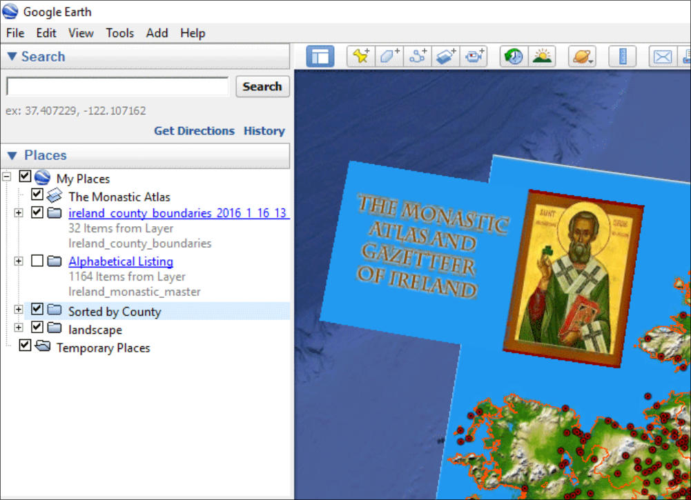
The Monastic Atlas and Gazetteer of Ireland
The monastic Atlas and Gazetteer is a Google Earth finding aid developed from the Wikipedia
listing of 1,165 monastic institutions in Ireland.
The file contains several sub folders shown to the right.
•
A set of accurate county boundaries
•
An alphabetical listing of the monastic institutions sorted by name
•
Institutions grouped by county
•
A landscape background for ease of viewing the location of the
institutions
Using the Atlas
If you are not familiar with Google Earth the following tips and tricks will be useful.
•
The individual folders can be toggled on or off. So for example if you want to hide the
landscape click the black check mark beside the landscape folder off. To turn it back on
simply recheck the box.
•
You should only view the Alphabetical listing or county listing by themselves as they contain
the same information, but organized differently.
Finding an Institution
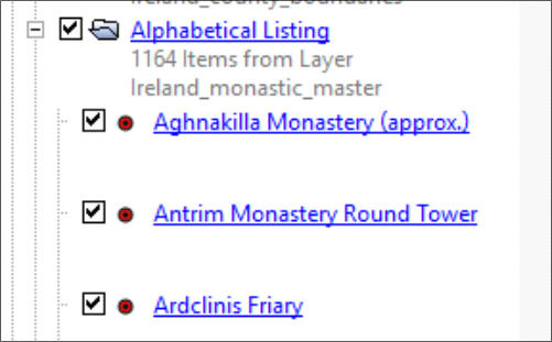
If you only know the name of an institution use the
alphabetical listing to locate the institution Mouse
Click on the + sign on the alphabetical folder. A
drop down list will appear(see right). Scroll thru the
list until you find the institution. Double left mouse
click on the name and it will be found on the map.
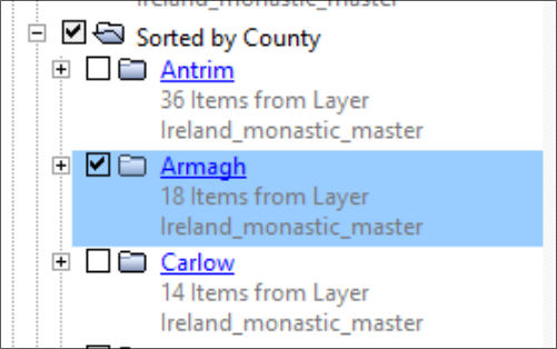
Displaying one counties institutions
To display one counties institutions turn off the alphabetical listing and
also the “Sorted by County listing”. Click the check box beside the
desired county and a listing of counties will appear. Check Armagh and
only the institutions in armagh will be shown on the map.
Displaying labels for Institutions
This should only be done when viewing a single county of a region on which you
have zoomed. Otherwise at the national scale labels overlap and cannot be
distinguished.
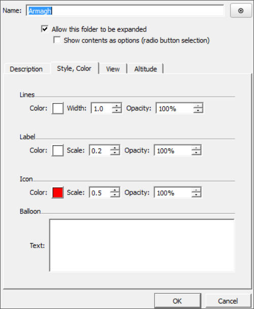
For example selecting a county, right click on the county folder and select
“properties” and then “Style, Color”. The menu to the right appears. Under label
click the up arrow to increase the size of the label to suite your viewing needs.
If you want to view the labels for several adjacent counties or an area on which
you have zoomed first select the + sign beside the “sorted by county folder. Then right click the
“sort by county folder”. Right click the “Sort by County” folder and select properties from the drop
down menu. Select “Style, Color”, and then select “Shared style”. Use the up arrow to increase the
size of the font.
Click Images to enlarge